

BRIDGELANDS · WOODBRIDGE, VAUGHAN
Bridgelands gallery: homes, streets and the park
The Bridgelands gallery collects the builders’ renderings of the community: the park, the streets and the homes. Every image is an artist’s concept, drawn before construction, so treat it as a guide to the architecture and the feel of the place rather than a photograph of a finished street.
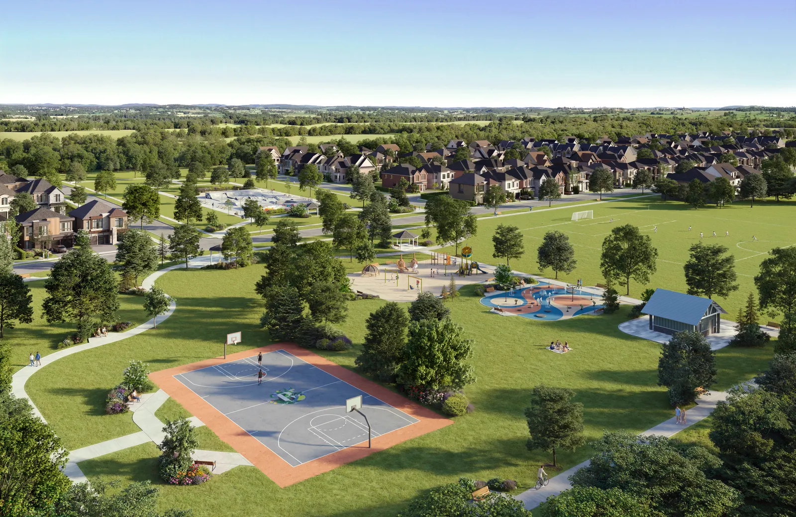
The community park rendering shows the open space the master plan is built around: a playground, a splash pad, sports courts, fields and paths, with homes framing the edges. The plan calls for more than 25 acres of parks and open space across Bridgelands.
The streetscapes show how the homes of Arista, DECO and OPUS meet the street. The OPUS streetscape mixes detached homes and towns in brick and stone along a tree lined road. The DECO streetscapes show detached homes with front garages and a row of lane detached homes, where the garages are at the back and the fronts are porches and windows.
The townhome renderings cover Arista’s Courtyard Lane and Dual Front Towns, OPUS Back-to-Back and Laneway Towns, and DECO’s courtyard lane towns. The detached renderings include designs from Arista, DECO and OPUS on 26 to 42 foot lots, many shown in more than one elevation.
Each model page carries its own rendering, and the floor plans tab lets you switch a model card between its rendering and its floor plan once you are registered. The builder brochures, also unlocked with registration, show every elevation for each model with its area.
Some items shown in renderings may be upgrades, and colours, materials and landscaping can change. Ask your sales representative which elevation and finishes are standard for the model you like.
Alongside these renderings, the community map on the location page is drawn from the builders’ brochure. It marks the site between Kirby Road, Weston Road, Teston Road and Pine Valley Drive, with Highway 400 to the east, and is not to scale.
